Good to know
Directions
The starting point is the parking lot at the end of Heimgartenstrasse in Ohlstadt. From the parking lot, follow the forest road in an easterly direction. The path is marked throughout with the number 443.
First it goes steeply uphill and after approx. 300 m follow the marking on the right. The forest path leads to a steep path again to the right, which we follow uphill. The forest road is crossed again; the path continues uphill through the forest on the other side. At the next fork in the road, follow the signs to the left to Kaseralm. The path here goes over wooden planks through the Hingmoos, which can be very slippery depending on the weather.
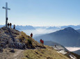
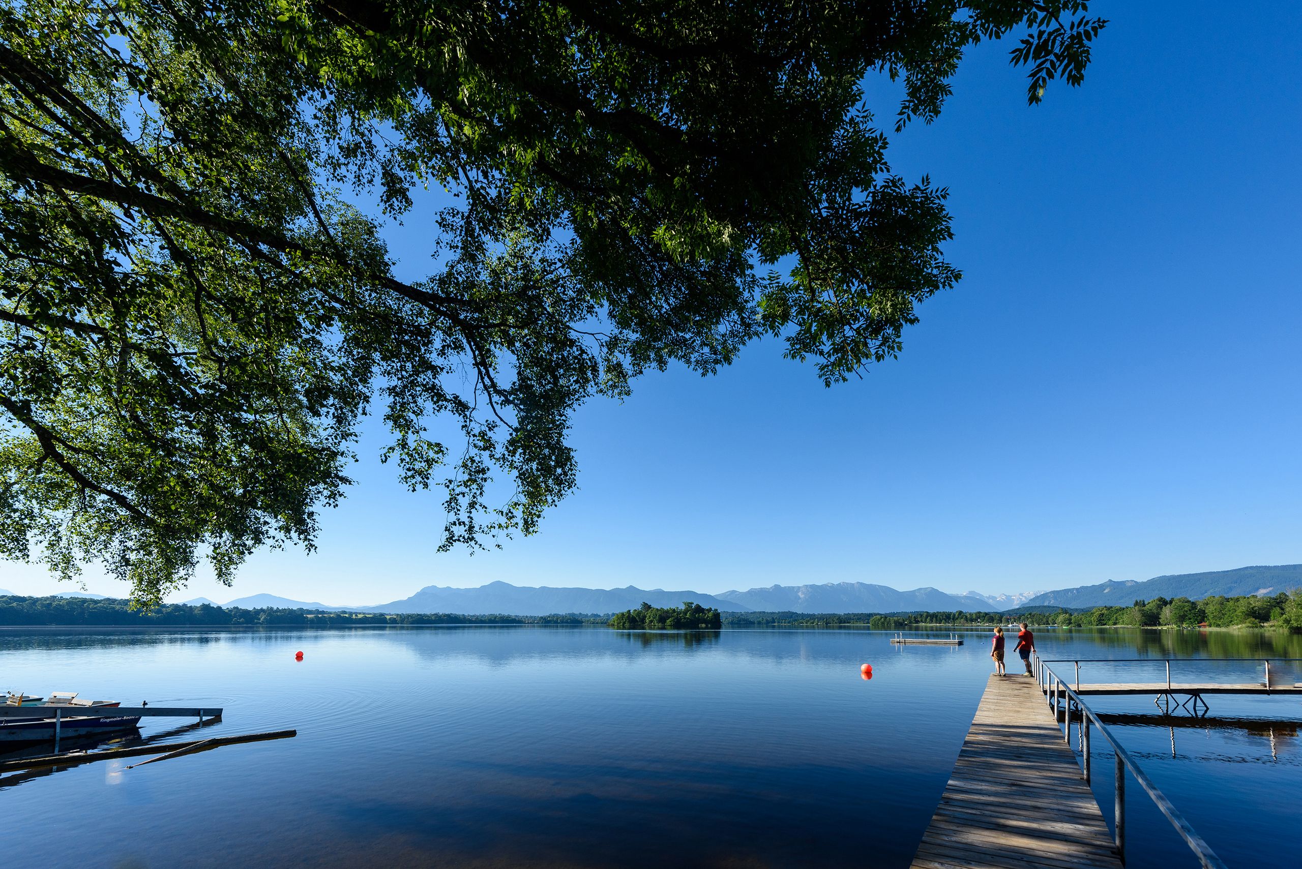
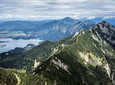
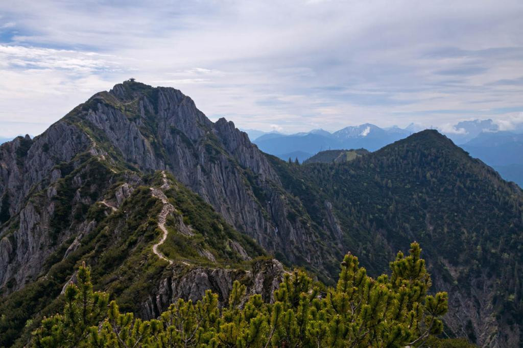
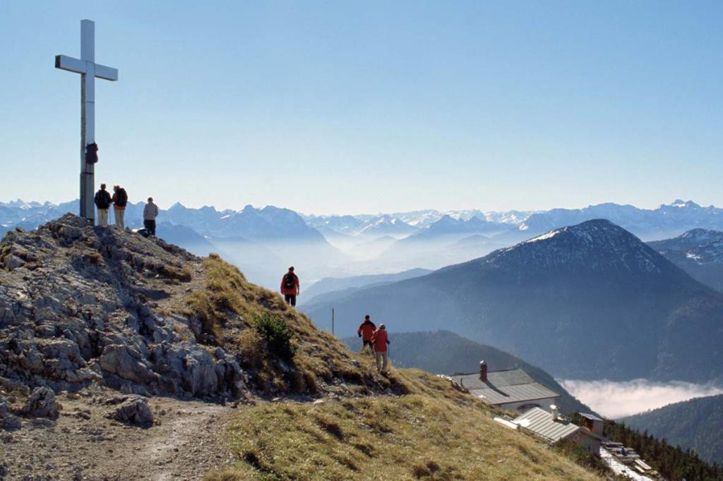
The pasture floor of the Kaseralm is soon reached and continues past the Weilheimer Kreuz and below the Rauchköpfl through the cirque steeply uphill. A certain degree of sure-footedness is also required here. Once on the ridge, it is only a few meters to the summit of the Heimgarten, which offers a magnificent view of the foothills of the Alps and the Alps. The Heimgarten Hut below the summit invites you to take a leisurely rest.
The descent takes place along the ridge to Feichtel, here too the path is marked with numbers 443 and 441. It goes steadily downhill, past the Bärenfleckhütte. After crossing the Kaltwasserlaine you will meet the ascent path, which you will now follow downhill to the starting point.
safety instructions
In an emergency, please contact the nearest rescue control center. Regardless of your location, you can reach them anywhere in Germany by calling 112.
The hiking and cycling paths we describe are primarily used for forest management; you use them at your own risk (Section 14 Para. 1 BForestG).
Facilities
hiking boots
Backpack with snack and drinks
Weather-dependent functional clothing
Sunglasses and sunscreen
Possibly sticks
Other personal items
Author's tip
Arrival & Parking
Public transportation
Bus stop: Ohlstadt town center
Bus routes:
9607 Murnau - Ohlstadt - Ettal and back (Note: only open on Saturdays on school days at the Ettal monastery school!)
9611 Kochel - Schlehdorf - Großweil - Ohlstadt - Murnau (Note: The Glentleiten open-air museum is only served from April to October!)
Guests in the "Blue Land" region and the "Ammergau Alps" region can use a variety of bus lines and train lines from Murnau to Oberammergau and from Uffing to Garmisch-Partenkirchen free of charge with the electronic guest card or KönigsCard. Further information can be found at: https://www.dasblaueland.de/Service/mobil
Map
UK L18 Bad Tölz – Lenggries and surroundings Bavarian State Surveying Office 1:50000
You can obtain maps from the tourist information centers and the municipal administrations in the Blue Land. You are welcome to order brochures using our brochure ordering tool at www.dasblaueland.de.
More information / links
author
Ammergauer Alpen GmbH
Organization